Known for its sunny weather and massive coast line, southern California is also home to some of the best hiking trails. Whether you love the mountains, beaches, valleys or deserts, you are bound to find the perfect hiking excursion. Here is a list of a few of the best trails to explore.
Joshua Tree
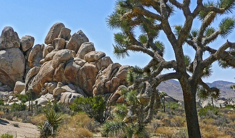
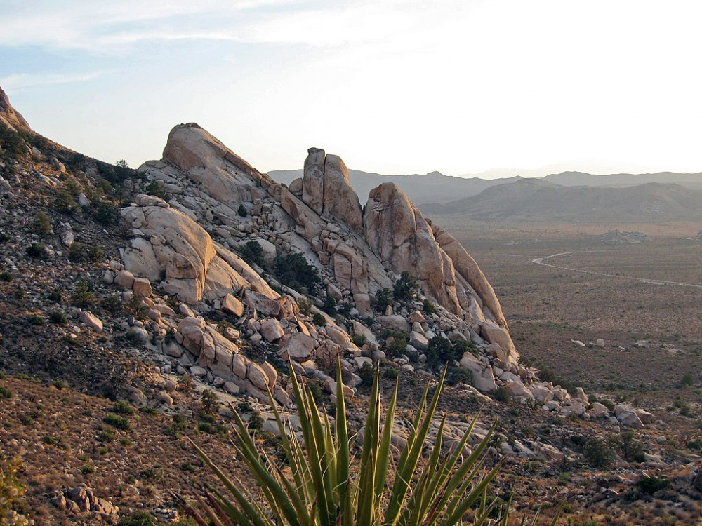
Located two hours outside of Los Angeles, Joshua Tree National Park spans almost 800,000 acres. Most of which is designated wilderness and home to its namesake Joshua Trees (Yucca brevifolia). Joshua Tree is where the Mojave Desert and the Colorado Desert meet. There is extreme heat in the summer months and hiking is not recommended during daytime in July and August.
Popular Trails
Note: Pets are not allowed on trails at Joshua Tree.
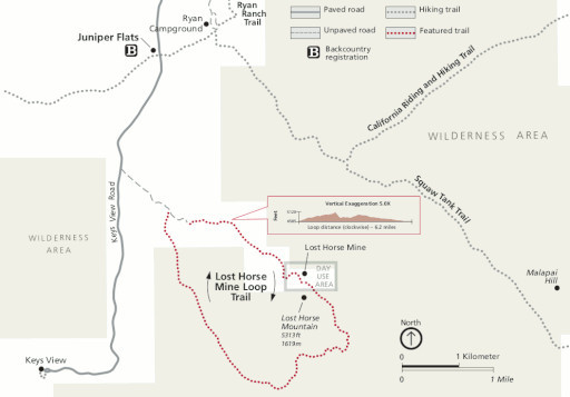
Lost Horse Mine Loop. Difficulty: Moderate Distance: 6.5miles Elevation: 550 ft Estimated time: 2-3 hours
Located off Keys View Road, this trail will take you around one of the parks preserved gold mines. Protected areas are fenced off and should not be entered. The trail makes a loop around Lost Horse mountain offering some pretty good views of Pleasant Valley.
Barker Dam. Difficulty: Easy Distance: 1.1 miles Elevation: 50ft Estimated time: 30-40 min
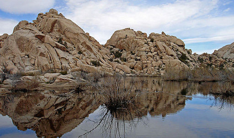
This trail is perfect for views of wildlife like bighorn sheep and an array of plants. One of the highlights is the stories of people of the desert told through rock art. This trail is especially beautiful after a good rainfall causing the dam to fill with water. Due to the portion of the trail being comprised of granite boulders, Baker Dam is not accessible by persons in wheelchairs or strollers. 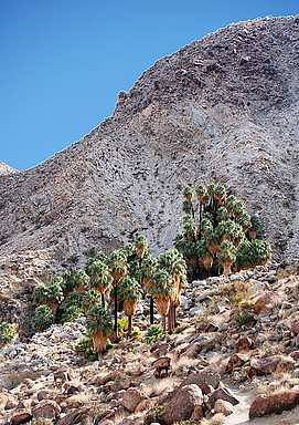
Forty Nine Palms Oasis. Difficulty: Moderate-Challenging Distance: 3.1 miles Elevation: 300ft Estimated time: 2-3 hours
This out and back trail leads you over a barrel cactus lined ridge where you will find a slightly steep descend to an oasis of fan palms (pictured). The oasis of palms will offer a welcome break from the sun.
Ryan Mountain. Difficulty: Challenging Distance: 3 miles Elevation: 1050ft Estimated time: 1.5-2.5 hours
If you are looking for the best views of the park, this popular out and back trail will not disappoint. Offering views of the San Bernardino Mountains, the magnificent rock formations (Wonderland of Rocks) of Joushua Tree, and miles of panoramic desert views. It begins to incline right away up a combination sand and boulder step path.
Angeles National Forest/San Gabriel Mountains
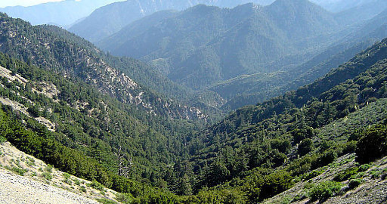
Angeles National Forest became the nation’s second national forest and California’s first in 1908. It spans roughly 700,000 acres with an elevation range of 1200ft to 10,000+ft, and is home to some of the most amazing hiking trails in California. The San Gabriel Mountains located within the forest are known to be some of the steepest mountains in the USA and became a national monument in 2014. There is 557 miles of hiking trails to enjoy.
Popular Trails
Bridge to Nowhere. Difficulty: Moderate Distance: 10 miles Elevation: 1100ft Estimated time: 4+ hours
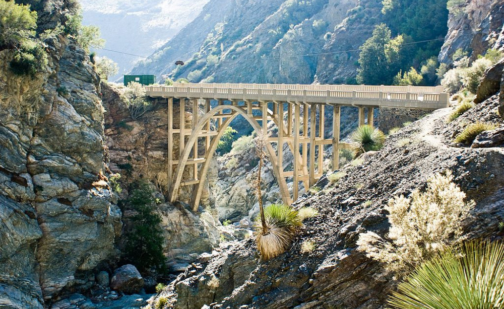
The Bridge to Nowhere trail crosses over the San Gabriel River a few times during the 10 miles. Usually easy to cross without getting too wet by stepping on some stones, but after a heavy rain the river water can rise quite a bit. The bridge was built in 1936 as part of a road connecting Wrightwood and the San Gabriel Valley. Unfortunately, two years later, a storm washed the road away leaving the bridge now to nowhere.
Echo Mountain Hike via Sam Merrill. Difficulty: Moderate to Difficult Distance: 5.4 miles Elevation: 1400ft Estimated Time: 3 hours
Echo Mountain hike is an out and back trail that offers views of the cities of Pasadena and Altadena out to DTLA. Though the elevation is 1400ft and it is a consistent ascend up, there are very few steep inclines making this hike good for most levels of hikers.
Hollywood Sign / Griffith Park

Griffith Park has 53 miles of hiking trails that are open sunrise to sunset. What better way to spend a day in the beautiful city of Los Angeles than hiking to the top of the historic Hollywood Sign. Located in Griffith Park where there is 53 miles of hiking trails including the fire roads, also landmarks such as The Greek Theatre and The Griffith Observatory. It offers spectacular picturesque views of the movie making town. There are multiple ways to hike to the iconic sign offering moderate to challenging hiking experiences.
Popular Trails
The Brush Canyon Trail. Difficulty: Moderate to Challenging. Distance: 6.5 miles Elevation: 1050ft Estimated time: 2-3 hours
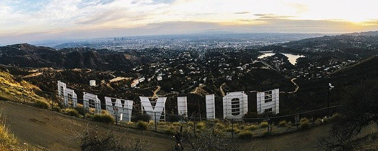
This Griffith Park out and back trail is great for the experienced hiker but may present challenges for those who are new to hiking. Along the hike to the top you will want to look out for coyotes, bobcats, and especially rattlesnakes. This hike will lead you behind the Hollywood Sign for best views of the city including downtown LA, and on a clear day, you will be able to see the ocean in the distance.
Mt. Hollywood Trail. Difficulty: Easy to moderate Distance: 3 miles (Observatory to Mt. Hollywood) Elevation: 500ft Estimated time: 1-2 hours
One of the most frequented trails at Griffith Park, this trail is good for families and of course dogs are welcome. It offers a good off-centered front view of the Hollywood Sign. Mt. Hollywood is the mountain next to Mt. Lee the mountain that host the sign.
Brand Park / Glendale, Ca
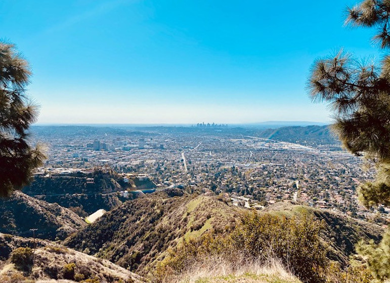
Brand Park is home to several trails located in the Verdugo mountains of Glendale, CA. Offering spectacular views of Glendale, Burbank, and downtown. It’s an area that is usually perfect for those that want to avoid crowds.
Brand Loop Trail. Difficulty: Moderate to Challenging Distance: 5.9 miles Elevation: 1500+ feet Estimated time: 2 hours
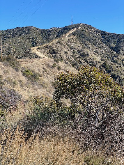
This loop trail can be challenging depending on the direction you choose to hike. Hiking clockwise will lead you through partially paved and gravel fire roads. This route has a moderate steady incline and is a wide path for those hiking with strollers or kids. It also offers plenty of shade. For a more challenging hike start counter-clockwise. This route is a bit more scenic with beautiful views of the surrounding cities below. It is almost entirely exposed by the sun so don’t forget the sunblock. This trail has a steep and steady incline along a narrow dirt path (pictured below). 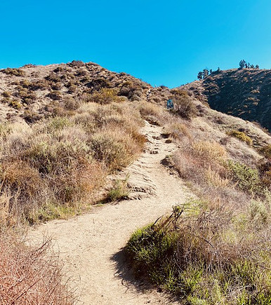
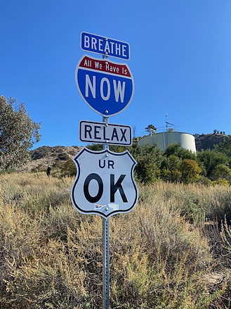
Once you reach the top there are a couple of benches to rest and take in the spectacular views of downtown, Glendale, and Burbank. At this point many people head back down but a few attempt to hike even higher to the radio towers. Hiking to the radio towers is an almost completely vertical intense climb. Hiking poles are recommended. The temptation is sort of hard to resist for the experienced hiker (pictured below).
Come Hike Southern California!
This was just a handful of the hundreds of trails southern California has to offer. From the vast desert to some of the iconic landmarks of Los Angeles, it is truly a site to explore. Use this as a starting point for your hiking journey has the adventure never really ends.
Happy Hiking!
Excellent collection of some beautiful and iconic places to hike in Southern California. As a tourist, I really loved getting so close to the HOLLYWOOD sign that I’d seen in pictures for so many years. A trip to see the Joshua Tree park is next on the list so that you for all the information (including that pets are not allowed on those trails)!
Thanks for your feedback. You are definitely going to love Joshua Tree!